Start and finish
San Gil
Race headquarters and Santander's tourism capital, at 1,114 m. The 80K and 100 miles start here, and the marathon, 80K and 100 miles finish here, at El Puente Shopping Center.
Seven towns · one canyon
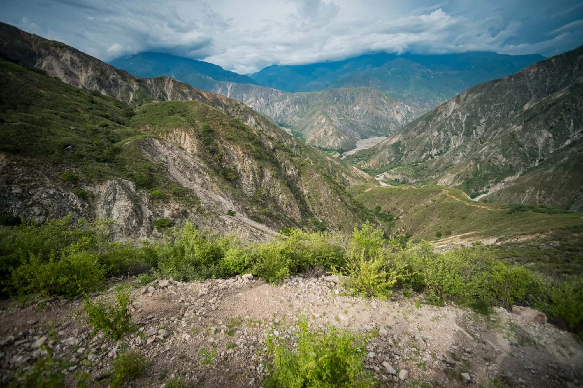
Four routes that cross the Chicamocha Canyon and link seven towns in Santander, Colombia, along royal roads, colonial villages and breathtaking lookouts.
The territory
Chicamocha Canyon Race runs through the Chicamocha Canyon and seven towns of the Guanentá province in Santander: San Gil, Barichara, Villanueva, Jordán, Curití, Mogotes and Aratoca.
The race has two start points, San Gil and Jordán, and two finishes, San Gil and Barichara. Along the way you'll find cobbled royal roads, dirt tracks, mountain trails and colonial streets, at altitudes ranging from the Chicamocha River, around 470 m, to 2,150 m at the K45 summit in the 100 miles.
Seven towns
Start and finish
Race headquarters and Santander's tourism capital, at 1,114 m. The 80K and 100 miles start here, and the marathon, 80K and 100 miles finish here, at El Puente Shopping Center.
Start · checkpoint
A village of adobe and cane houses at the bottom of the canyon, on the banks of the Chicamocha. Start of the half marathon and marathon, and a checkpoint with drop bags in the 80K and 100 miles.
Checkpoint · all distances
A young town of wide streets and hard-working people, at about 1,450 m. A cut-off in the half marathon and marathon, and crew access in the 80K and 100 miles.
Half marathon finish · crew access
Known as Colombia's most beautiful town, a national monument of cobbled streets and stone and rammed-earth architecture. Finish of the half marathon and a crew-access checkpoint for the other distances.
100 miles
Home of fique fiber crafts. Its main square is a 100-mile checkpoint with hot food, the first drop bag and crew access.
100 miles
Its nature reserves and old cobbled paths are part of the 100 miles' first big climb, along the high ground on the canyon's left bank.
100 miles
A canyon town on the Eastern Andes. Its main square is a 100-mile checkpoint with a cut-off, hot food and crew access; next come the Picacho de Aratoca and the descent to Panachi.
How they connect
| Section | What you'll find | Distances |
|---|---|---|
| San Gil → Las Vueltas → Morros → Jordán | San Gil's switchbacks, royal roads and dirt tracks, the Las Vueltas heights and the descent to the canyon floor | 80K (km 0 to 35.4) |
| San Gil → Pitiguao → K45 → Curití → Aratoca → Panachi → Jordán | The high ground on the canyon's left bank, cobbled paths in Mogotes and Curití, the race's high point at K45 (2,150 m), the Picacho de Aratoca and the technical descent from Panachi | 100 miles (km 0 to 120.5) |
| Jordán → El Punto → Villanueva → Barichara | The Camino Real de Aposentos, a climb of about 1,200 m; Alto de Marta, the Tierra Negra trail and the Cuartel de Bolívar | All four distances (23.9 km) |
| Barichara → Hotel Carigua → San Gil | The climb to the antennas and Carigua (1,811 m) and 13 km of descent into San Gil | Marathon, 80K and 100 miles (22.1 km) |
The half marathon finishes in Barichara. Distances taken from the official checkpoint tables.
Elevation
23.9 km · +1,527 m
46.0 km · +2,338 m
81.4 km · +3,587 m
166.5 km · +6,712 m
Maps
Course marking
The organization marks the route days before the race, re-marks it before the runners come through and checks it during the event. Even so, in some places people unrelated to the race remove markers, so we ask you to carry your distance's track on your watch or phone.
You must always follow the marked trail: breaking the mandatory-trail rules is grounds for disqualification. If the race management changes the course for safety reasons, it is announced at the previous checkpoint or at the point of the change. See the rules.
Navigation
From your distance map on Trace de Trail, linked on this page. Download it before you travel and load it on your GPS watch or on a phone app that works offline, so you can follow the route even without an internet connection.
No. GPS is on the recommended gear list. What is mandatory is a mobile phone with calling credit, which is also how you report incidents or emergencies to the numbers printed on your bib.
Distance and elevation may vary between watches, apps and mapping software. To plan your race, go by the kilometer marks in the official checkpoint table for your distance.
Go back to the last marker you saw and compare your position with the track. If you still can't find your way, call the race incident line printed on your bib, give your name, bib number and distance, where you are and the nearest checkpoint, and follow the organization's instructions.
Remember that passing through every checkpoint, in order, is mandatory: if you miss one, you must make your own way back to it, without using any vehicle, and restart from there. Using any kind of transport, even to go back, means disqualification.
Start with your watch and phone fully charged and turn on battery-saving mode. In the 80K and 100 miles the night is part of the race: that is why a headlamp with spare batteries is mandatory, and your devices should last to the finish too.
Landscape
Compare the four distances and secure your place in edition 15, 4–7 June 2027.